
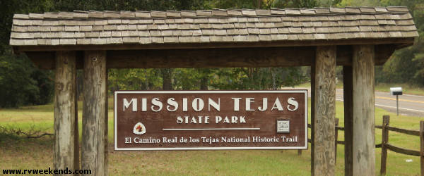
Mission Tejas State Park
October 2019
Mission Tejas State Park was the last destination of our four-park journey from central Texas to northeast Texas. As we drove from park to park (Fairfield State Park, Purtis Creek State Park, and Daingerfield State Park), we ventured further away from our home in central Texas. We selected Mission Tejas State Park as our last destination because it was along an indirect route back home, thus shortening any single day's travel time.
After leaving Daingerfield State Park, we drove cautiously south on 159 towards Longview through high winds and heavy downpours. After about an hour of driving with clenched teeth and a tight grip on the steering wheel, we pulled into the flooded parking lot of a Cracker Barrel on I-20 to take a break from the rain and have lunch. The strong wind was from the north, and temperatures were dropping fast. Inside the warm restaurant, bikers enjoyed hot coffee at a corner table not far from our two-seater by the fireplace. I bet those guys won't be leaving any time soon, I thought.
After a meal of chicken fried steaks, we headed south on Highway 322 to Henderson, then east on 79 through Rusk and Alto, to the northern end of Davy Crockett National Forest, and traveled further east on 21 to Park Road 44. The rain didn't stop until we arrived at Mission Tejas State Park. The skies remained cloudy, and the cold wind continued through the afternoon.
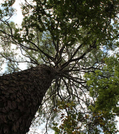
We checked in at the park headquarters and navigated down wet roads to soggy tree-covered campsite #7. As soon as we got our trailer positioned and leveled, I walked over to the driver's side door of my truck and reached in to turn off the engine, then suddenly, WHAM!! A heavy limb fell from the tree above and slammed onto the windshield and top of the cab. The rotten limb exploded on impact and spread shards of bark and decayed wood everywhere. We were startled by the powerful crashing sound and thought the windshield had broken and the cab had caved in. After I cleaned up the debris, I determined there was no damage, not even a scratch. I doubt we would have been so lucky if the limb had hit us!
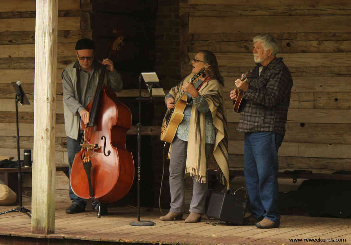
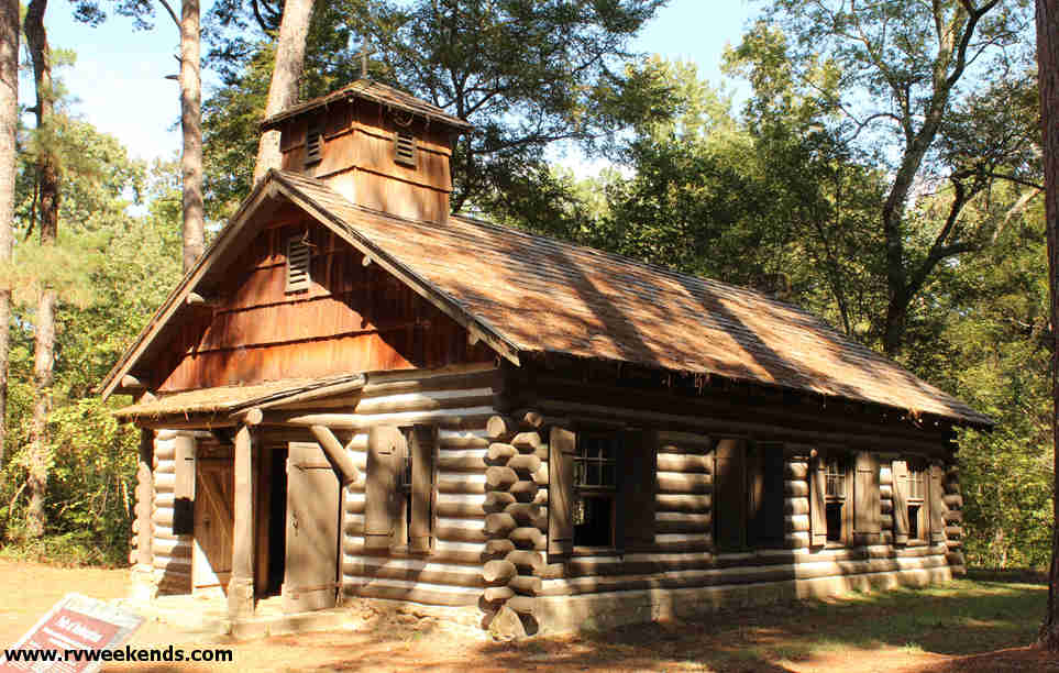
On Saturday morning, temperatures had dropped to the low forties. We ate breakfast and hiked down the moderate half-mile Karl Lovett Trail, through a forest of pines and hardwoods, to a folk music festival at the Rice Family Log Home near the park's entrance. It was chilly and cloudy, but the air was dry and calm. We enjoyed two local folk music groups playing such instruments as the guitar, mandolin, banjo, and stand-up bass while children played horseshoes and bean bag toss nearby.
After the music festival, we hiked the .64-mile Big Pine Trail back towards our campsite. Several sections of the trail were under construction during the time of our visit, thus making it challenging on the difficulty scale. Back at camp, we had BLT (bacon-lettuce-and-tomato) sandwiches for lunch while we planned our afternoon activities.
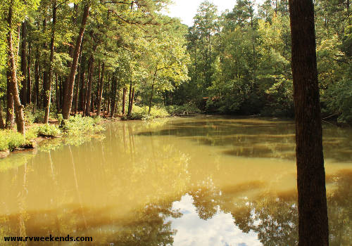
After lunch, the skies cleared, and the temperatures became warmer and more bearable. From our campsite, we hiked a short distance down a hill towards the Group Picnic Area. We passed a gathering of folks celebrating someone's birthday under a sizable pavilion that covered many picnic tables. Beyond the picnic area was a small pond the CCC built for the park in the 1930s.
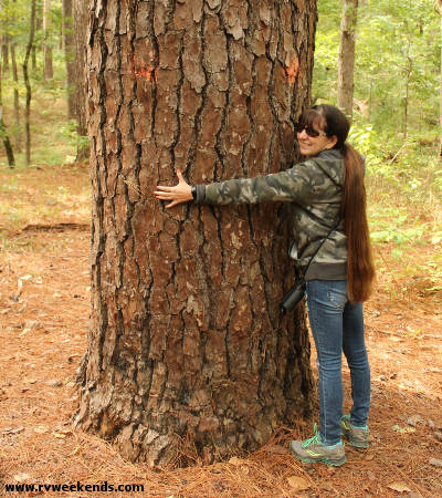
We hiked the half-mile Tejas Timber Trail to the Cemetery Hill Trail, then took the Lightning Trail a short distance to the Sentry Pine. This pine was said to be over 100 years old and one of the largest and oldest pines in the park.
At 3 pm, we met the park's superintendent at the Commemorative Mission for a group presentation about the construction and history of the replica. The Civilian Conservation Corps (CCC) built the Mission replica in 1934. According to the park's literature and other online resources, the Spaniards built the original mission around 1690 in a nearby Caddo Indian village. Continuous contact with the Europeans brought diseases to the Caddo, and they soon became unfriendly towards the Spaniards. About three years later, the Spaniards burned down the mission and fled to Mexico. The Caddo Indians once numbered about a quarter of a million people, but as the number of Europeans settling in the region increased, the number of Caddo decreased. The tribe's population was reduced to nearly 1,000 in the Washita River Indian Territory, Oklahoma, in 1859. There is quite a bit of information about the Caddo Indians online - we plan to do more research before our next visit to Mission Tejas State Park.
While standing in the old mission and listening to the park superintendent recap the history of the Europeans and the Caddo Indians, I couldn't help but wonder what life must have been like at the very place we were standing over three hundred years ago.
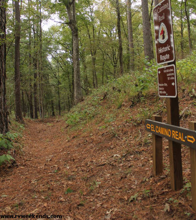
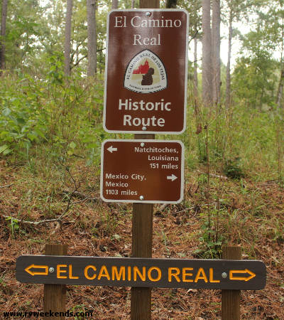
The superintendent completed his historic talk with a short hike to the El Camino Real. This small section of trail (that passed through present-day Mission Tejas State Park) was said to be a part of the original El Camino Real - a route between Louisiana, San Antonio, and Mexico that travelers used from the late 1600s to the 1800s. Davy Crockett and Sam Houston were said to have traveled these roads during the battle for Texas independence. Countless others used these roads to conduct business and to settle the Texas frontier. In 2004, the United States Congress designated the El Camino Real de los Tejas as a National Historic Trail.
One of the fascinating stories we heard at Mission Tejas State Park (and later read on visitnacogdoches.org) was the history behind Texas' name. When the Caddos first met the Spaniards, they greeted them by hollering "Taychas!" meaning "friend." The Spanish began calling the Caddos "Tejas." The area became known as the Province of Tejas, which later became Texas.
While hiking back to our campsite, we passed the folks on the site next to us. The two of them were sitting at their picnic table eating dinner. I had briefly met them the day before.
"Howdy folks, it sure turned out to be a beautiful day," I said.
"Yes, the weather couldn't be better," they replied.
"Did you guys say yesterday that you were from Round Rock?"
"Yes, and you guys also live in Round Rock, right?"
Well, that was all it took to get a 30-minute conversation started about everything from RVs to grasshoppers.
We enjoyed our time-limited visit to Mission Tejas State Park. We planned to return to the park in 2020 to visit the Caddo Mounds Historic Site, but COVID changed our minds.
Our adventure to four Texas State Parks in the fall of 2019 had come to an end. Throughout our 9-day journey, we viewed magnificent scenery, hiked tree-covered trails, learned about history, experienced all kinds of weather, and met some interesting folks. Where will we go next?
What Next?
Check out the three other Texas State Parks we visited on this trip (Fairfield State Park, Purtis Creek State Park, and Daingerfield State Park).


