
Daingerfield State Park
October 2019
Daingerfield State Park was the third destination of our 4-park journey from central Texas to northeast Texas. I was genuinely looking forward to visiting Daingerfield State Park because of the scores of magnificent fall-color photos of the area that I found online - but also because of my family history - many of my ancestors settled in the area in the 1800s.
After leaving Purtis Creek State Park, we drove north about twenty miles on Highway 198 to Canton and had salads for lunch at Buttermilk's Restaurant. After our meal, we headed northeast 13 miles to Grand Saline, then turned east on Highway 80 to Mineola. From Mineola, we turned north on Highway 37 toward Quitman and Winnsboro, then east on Highway 11 through Pittsburg and Daingerfield, and finally, 2.6 miles further east to Daingerfield State Park's entrance.
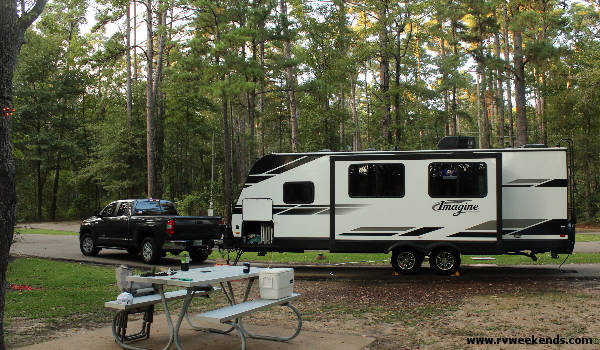
After checking in at the Daingerfield State Park headquarters, we drove into the narrow pavement of pull-through site #7 in the Big Pine camping area. Before I turned off the engine of our tow vehicle, our neighbor from campsite #4 walked over to greet us.
"You have your vehicle turned the wrong way," he said. "You need to point it in the other direction so that you can hook up your sewer and water connections."
"I parked this way on purpose," I said with a smile. "I wanted our slide-out to face the lake so we could take in the view while enjoying our morning coffee."
"Ah, good thinking," he said with a smile.
"This is a beautiful park," I said while admiring the magnificent pine trees and shimmering lake.
"Yes. It is the most charming of all of the Texas State Parks. It is a small park, but there are many things to do. If you like hiking, there is a 3-mile trail that surrounds the lake and another shorter trail to the highest point in the park."
"We'll hike them both," I said.
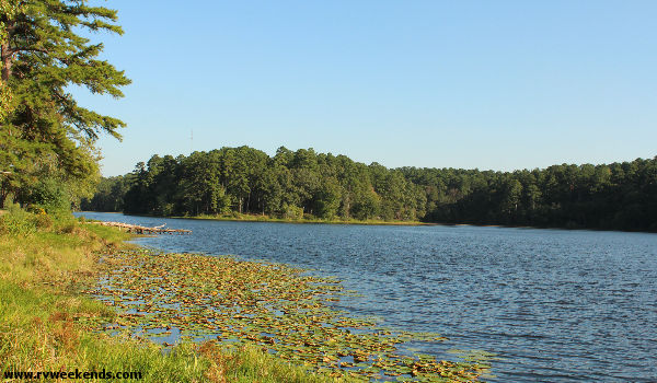
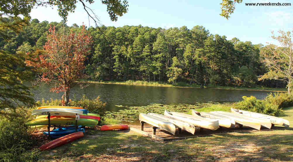
After we leveled our trailer and hooked up the utilities, we drove a short distance to the park's store and explored the day-use area. The water in the lake was clear enough to easily see three feet to the bottom at the fishing pier.
The park rents canoes and kayaks as well as paddle boats and boards. Between the park store and the banquet hall was a cool breezeway and dance floor area with a disco ball and jukebox. We bought a refrigerator magnet and a couple of ice cream sandwiches from the park store and enjoyed them at a picnic table by the lake.
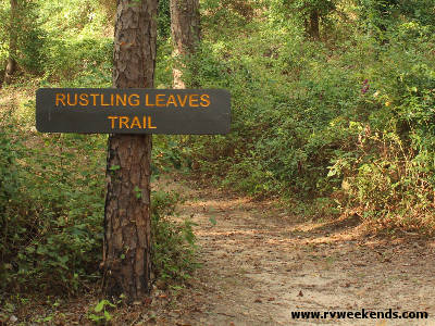
On Thursday morning, we set out to hike the park's two nature trails, the Rustling Leaves Trail and the Mountain View Trail, totaling about 3.6 miles. One section of the Rustling Leaves Trail loop passed directly between our campsite and the lake, so we began hiking from there.
As soon as we commenced our hike, we met a family of hikers approaching us.
"Good morning," I said as they got closer.
"Good morning," one gentleman said. "Be careful. We saw a copperhead snake up the trail about 1000 yards."
"Thanks for the warning," I said, thinking about how he might have calculated that distance, given that the stretch of trail is only about half that long.
"We'll be on the lookout," I responded.
We never saw the snake, but we kept our eyes open. We were on a hike once at Village Creek State Park, where a copperhead slithered across the trail not five feet before us.
The Rustling Leaves Trail appeared to end near the day-use picnic area, about a quarter of a mile from our campsite, but it picked up again on the other side of the park store and fishing pier. It was also the location of the Mountain View trailhead. We decided to hike the 1.2-mile Mountain View Trail, then the 2.4-mile Rustling Leaves Trail loop that would ultimately take us back to our campsite.
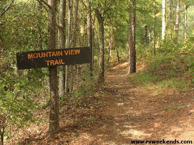
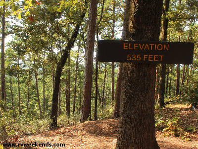
The Mountain View Trail had a difficulty rating of Challenging, depending on which combination of the Mountain View trails you chose to hike. Any hike will take you to the scenic overlook at the highest point in the park (538 feet). There was a bench overlooking the trees and hills beyond. "I wish I had brought my book. I could stay up here all day," a hiker said.
The three sections of the Mountain View trail were aligned such that if you wanted to hike them all, you would be walking at least one of them twice. But I think that was a good thing. There was plenty of nature to be enjoyed and absorbed in the (already too short) 1.2 miles of spectacular trails.
On the Daingerfield State Park Trails Map, the lake was labeled Daingerfield State Park Lake, but it was called Little Pine Lake on the map. I think I liked Little Pine Lake better.
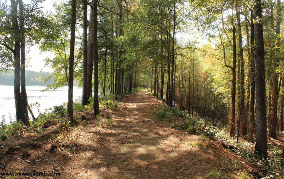
The Rustling Leaves Trail, considered Easy on the difficulty scale, meandered along the shores of the park's 80-acre lake through a forest of oaks, maples, elms, and loblolly pines. While hiking along the trail, we noticed charred bark on the trunks of many of the giant trees - evidence that there might have been a recent prescribed burn. The park rangers set these controlled fires to remove dead grass and invasive plants and return the land to its natural state.
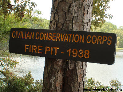
About a quarter of a mile down the trail, we arrived at the earthen dam that created Little Pine Lake. The dam was built in the 1930sby the CCC (Civilian Conservation Corps) from about 4,000 square yards of local iron ore.
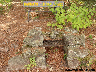
Further down the Rustling Leaves Trail, we reached an old bench and a barbeque pit that the CCC workers used as a picnic area. The CCC built several picnic tables and fire pits, but only one remained. We relaxed on the park bench and enjoyed lunch while taking in the scenic lake and peaceful tree-covered surroundings.
After a spell, we continued down the trail past the Dogwood Camping Area back towards the Big Pine Camping Area and shortly arrived at the point where we began our hike, our campsite - good ole campsite #7. Across the road from us, a frustrated man was trying to get his fifth-wheel rig parked on the narrow concrete slab of campsite #5. He pulled forward, then backward, then forward, then backward, then forward again, and finally, all of the way out of the site and started over. After another 15 minutes of back-and-forth, he finally parked it near where he wanted it and began unloading kayaks and setting up camp.
We relaxed at our campsite for a while, then grilled some burgers for dinner. After our meal, we began preparing for a cold front that was supposed to drop temperatures nearly 30 degrees, with severe storms possible. We stowed our chairs and other gear so they would not get wet or blow around in high winds.
After sunset, when there was barely any light in the sky, I noticed a kayak fisherman trying to plow through dense water lilies growing in the shallow waters along the shores of Little Pine Lake. He made it about halfway through the thick lilies, then jumped into the muck and dragged his boat to shore. He must have lost his way in the darkness, I thought. I grabbed my flashlight and walked towards the lake to provide some light.
"Did you catch any fish?" I asked.
"Nothing big enough to keep," he replied.
"I was planning to go fishing in the morning, but I don't think the weather will allow it," I said.
He agreed and continued dragging his kayak back to his fifth-wheel rig at campsite #5.
At 1 am, the front came through. Heavy rain pounded the roof of our trailer.
Friday morning, we woke up at dawn to a campsite that was 40° colder than the previous day. The fifth-wheel guy had already packed up and left the park. It was still raining, but the radar indicated we might get a break around noon. That's when we planned to break camp and head south to Mission Tejas State Park. Around 11 am, the rain stopped for about 30 minutes, just enough time to retract our slide and empty our sewer and grey water tanks, then started again as we drove out of the park and back onto Highway 11 West, towards the town of Daingerfield.
What Next?
Leave Daingerfield State Park and visit our home page.


