
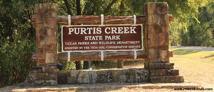
Purtis Creek State Park
October 2019
A Little History of Purtis Creek State Park**
The lands of Purtis Creek State Park were acquired from private property owners by the Texas Parks and Wildlife Department in 1977. In 1980, a dam was built on Purtis Creek to control floods, thus producing a 350+ acre fishing lake. The park opened to the public in 1988. Purtis Creek State Park is also located about 25 miles southwest of the site of the Cherokee War and the Battle of the Neches, fought in 1839, near the headwaters of the Neches River. There's a Historical Marker* posted at a roadside park on I-20 East, about a 30-minute drive from Purtis Creek, that marks the location of the historical battle between 800 native americans and 500 troops of the Republic of Texas (information I got from the Historical Marker).
Purtis Creek State Park
Traveling to Purtis Creek State Park from Fairfield Lake was difficult. There were periods when our trailer became unstable while traveling through gusty north winds along FM 488. I need to look into upgrading the sway controller assembly for the 30-foot trailer - the one we bought for our old 24-footer doesn't seem adequate, I thought. FM 488 passed between the Richland-Chambers Reservoir Dam and the Richland Creek Wildlife Management Area. There were signs posted along the road that read, Forbidden Zone.
The signs reminded me of the original Planet of the Apes movie, released in 1970, where a particular geographic region of the earth, known as the Forbidden Zone, was off limits to the apes to prevent them from discovering the truth of their past.
At US-287, past the Forbidden Zone, we turned right toward Cayuga, then trekked north on FM 59 through the town of Crossroads, then continued a few miles further north into Athens. We stopped at a Walmart for groceries, ice, beer, and a new ceramic heater for our trailer (taking Alex's advice - a fellow we met at Fairfield Lake State Park). After replenishing our supplies, we gassed up and headed northwest on 175 to Eustace.
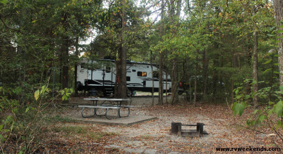
At Eustace, we traveled three miles north on Highway 316 to Purtis Creek State Park. At the park's headquarters, we picked up a park/trail map and navigated our way to campsite 30, where we spent the next two nights of our nine-day RV trip into northeast Texas. Purtis Creek was known for its bass fishing, and I was eager to bait my hook and find out for myself. Once we got the trailer leveled and hooked up to the site's power and water, I discovered a narrow tree-covered trail leading from our campsite to a small cove on the lake.
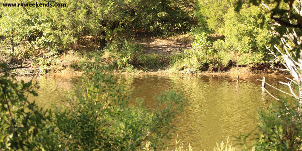
The tiny slough was thick with submerged stumps, and cattails, brush, and overhanging branches were growing thick along its banks. While exploring the area around the cove, I found an opening through the brush perfect for bank fishing. The ground at the water's edge was hard-packed and dry, probably from the many fishermen who have fished this spot over the years. I will try my luck tomorrow, I thought.
On Tuesday, we woke up to chilling temperatures. The cold air had settled in - the perfect opportunity to test our new ceramic heater. It performed just as Alex said it would. It heated the entire trailer from front to back. We cooked breakfast, drank coffee, and enjoyed the early morning hours in the warmth of our small vacation home on wheels.
After breakfast, I gathered my fishing gear and aimed for the cove. I attached an orange and green spinner bait to the end of my line and cast it out several times but did not get any strikes. They described the lake water as "clear," though it appeared to be brown, probably due to the color of the silty bottom. I switched to a pumpkin-seed worm and continued to cast. I could see into the shallow water about two feet and spotted a small gar a few yards from the bank. We didn't catch fish on Tuesday, but there was still time for fishing in the morning before we needed to break camp and journey to our next destination.
After about an hour of fishing, I walked back up to our campsite to begin a day of hiking. My wife and I outfitted ourselves for a short 1.5-mile walk on the Beaver Slide Nature Path. The scenic nature trail provided access to the park's primitive campsites, spaced apart along the western shores of Purtis Creek State Park Lake. Along the footpath, we came across a bird blind, built for viewing birds roosting in the small cove where I had been fishing. A little further down the trail, we heard the melodious song of a Brown Thrasher.

After lunch, we hiked another 4 miles on the three Wolfpen hike and bike trails. On the Purtis Creek State Park's trail map, the 1.4-mile northern section of the Wolfpen hike and bike trail is marked red. The 2.0-mile southwestern part of the Wolfpen hike and bike trail was labeled purple, and the .8-mile eastern Wolfpen trail was labeled green. We wondered why they didn't make up separate names for each pathway. So, if you say you were planning to hike the Wolfpen trail, which path should we travel to find your bootprints?
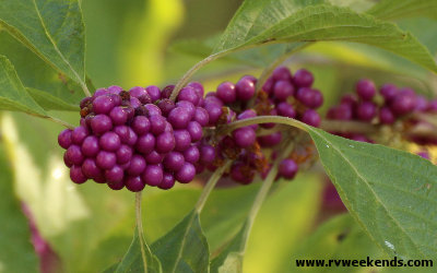
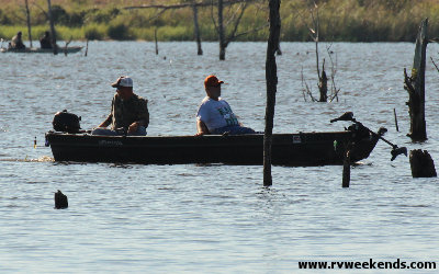
While hiking the Wolfpens, we discovered Beautyberry plants at almost every turn. The trail periodically passed views to the lake, where we spotted several Jonboats venturing out for a day of fishing.
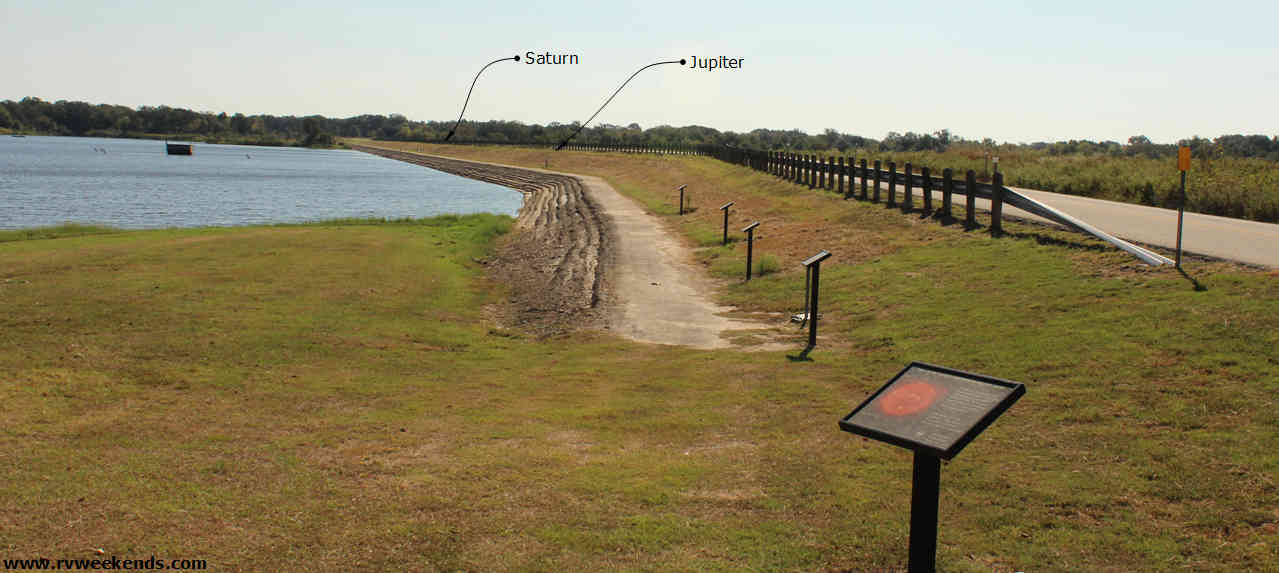
At the lake's dam, there was a .5-mile Solar Walk Trail that spread end-to-end along a concrete walkway on the lake side of the dam. The trail began with a sign that marked the sun's location and provided information about the sun (size, temperature, etc.). There were additional signs along the trail representing each of the eight planets of our solar system, spaced apart at their relative distances from the sun. It was an exceptional model that provided perspective on the position of the planets in our solar system. From Pluto's sign, you could barely see the sun's sign.
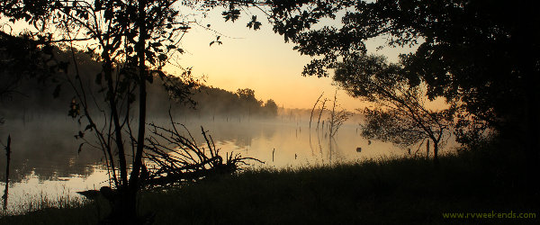
On the morning of our last day at Purtis Creek, I made one final trip down the trail to my private fishing spot. The air was cool and humid, and the smell of decomposing leaves on the forest floor was pungent and refreshing. I didn't catch any fish, but the magnificent sunrise reflecting off the low-hanging fog over the small cove was worth the trip.
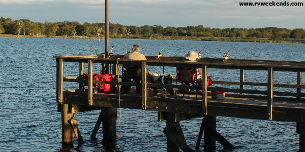
Fishermen crowded the fishing pier each day. I never saw anyone reel in a fish, but the seriousness of their intent made me think the fishing must be generally better than what I had experienced.
After we hooked up our trailer, we left Purtis Creek State Park around 10:30 and proceeded to the third park on our four-park adventure, Daingerfield State Park.
** Some information obtained from the park's literature.
* You can locate the Historical Marker on the Texas Historic Sites Atlas website. Search for Atlas Number: 5467011380
What Next?
Leave Purtis Creek State Park and visit our home page.


