RV Camping Colorado Springs
September, 2015
Until our Rocky Mountain trip to Colorado, most of our camping adventures had been to parks in the Gulf Coast states, from West Texas to Florida.
We departed Round Rock, Texas, at 9:05 a.m. on Friday to begin our 1700-mile 10-day round trip to Colorado Springs, Colorado. The weather was perfect for travel: the sky was clear, and the temperature was in the low 60s.
From Round Rock, we headed north on Highway 183 to Goldthwaite and turned west on Highway 84 through the towns of Zephyr, Early, and Brownwood, where we ate old-style chopped-beef sandwiches for lunch at the well-known Underwood Cafeteria (Est. 1946).
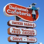
Feeling refreshed, we continued west on 84 through the small towns of Santa Anna, Coleman, Goldsboro, and Lawn, then left on Highway 83, through a screwy intersection (that I was happy to have gone through in broad daylight) to Tuscola. From there, our GPS took us through unpaved back roads (County Roads 613/275) to create as close to a bee-line route as possible to Abilene State Park.
One of the turns was so vague that a Smart Car slipped in beside us while we were making a last-minute course correction; that day, we learned what a Smart Car's horn sounds like.
Abilene State Park was only 3 1/2 hours into our trip to Colorado. We would have traveled further, but there weren't many viable overnight options along our chosen route. We prefer state parks over RV parks because the campsites are more wooded, spacious, and less expensive.
Abilene State Park has several semi-secluded campsites with thick canopies of large oak and pecan trees. The temperature had warmed considerably since our morning departure, and we were grateful for the shade on that 95-degree late summer day.
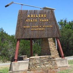
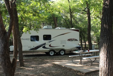
We settled into campsite #57 around 3. At 5 p.m., I fired up our charcoal grill and cooked a light dinner of lean steaks and sliced tomatoes. Afterward, we sat outside and enjoyed the evening. It felt good not to push things too hard on the first day.
Saturday
We left Abilene State Park at 8 a.m. and traveled through more backroads, 89 and 126. The road was an old two-lane that had no shoulder. The open countryside had become a wind farm since we last visited the area - hundreds of wind generators everywhere vanishing into the horizon. We took 126 to 153 and then north on 70 into Sweetwater, where we stopped for gas and a McDonalds breakfast.
After fueling up, we headed west on I-20 for a few miles and exited onto Highway 84 west through Snyder and Post to Lubbock, where we turned north onto I-27. In Plainview, north of Lubbock, we stopped for lunch and gas and picked up a few necessities at the nearby Wal-Mart before getting on I-27 north. We passed through Tulia and Happy on the way to Amarillo, where we stayed the night at Amarillo Ranch RV Park.
While checking in, the park host told us about the Big Texan Steak Ranch. They boast a free 72-ounce steak - if you can eat all of it (plus a baked potato, salad, three shrimp, and a roll) in less than an hour. The RV park provided a free limo ride to the restaurant.
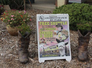
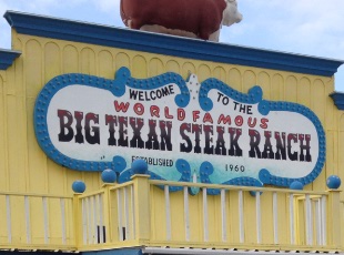
When you sign up for the 72-ounce steak challenge, they seat you center-stage and announce to everyone in the restaurant that you plan to consume this banquet for one. Once the food arrives, they start a 60-minute countdown timer, and off you go!
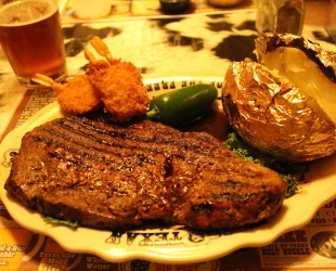
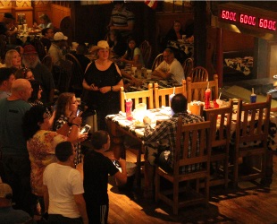
Two cowboys partook in the stomach-stuffing but did not finish the meal in less than an hour. One guy didn't even come close. People take the challenge to say they tried it; they don't care if they have to pay $72 for the meal. After all, you can always get a doggie bag and eat the steak later. Nothing has to go to waste.
In addition to the restaurant, the Big Texan Steak Ranch had a gift shop, a bar, and even an electronic shooting gallery; in the spirit of Halloween, it was stocked with zombies, ghouls, skeletons, and ghosts to shoot at. We also sampled ales from their Big Texan Brewery: the Palo Duro Pale Ale, the Texas Red Amber Ale, and their seasonal Oktoberfest. All three were quite excellent!
We took the limo back to the Amarillo Ranch RV Resort around 11 o'clock and crashed hard after the large meal and delicious ale. The RV park was just a block or two north of I-40 (route 66) - the sound of passing trucks and cars lasted through the night.
Sunday
After breakfast at Cracker Barrel on I-40, we headed north on 287 out of Amarillo toward Dumas. The scenery reminded me of scenes from the old west: expansive mesas, deep gullies, and a long coal train in the distance spewing black smoke.
At Dumas, we gassed up and proceeded north on 87 toward Dalhart, through flat grassland plains, fields of cotton and grain, and large cattle ranches, to the town of Texline and out of Texas.
We fueled up in Clayton, New Mexico, and continued on Highway 87, about an hour and a half, through the northeast corner of New Mexico. We grabbed a quick lunch in Raton and headed north on I-25 into southern Colorado.
The dramatic elevation changes on the freeway in southern Colorado severely mountain-tested our small pickup truck/travel trailer rig. There were a couple of inclines where I couldn't drive past 40mph. I feared that I-25 would be like this the whole way to Cheyenne Mountain, but just a few miles past Trinidad, the road grade mellowed to more mild changes in elevation, and majestic mountains began to appear as we traveled further north.
The trip through Colorado was an hour longer than expected (we didn't account for Mountain Time), but we arrived at Cheyenne Mountain State Park around 4 p.m., very tired from the 7+ hour trip, and ready to get away from I-25 traffic, relax, and settle into our 4-night stay.
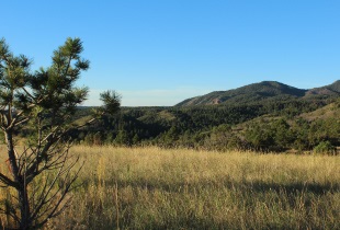
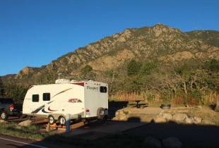
Our campsite was at the base of Cheyenne Mountain (9,570 ft.). The mountain scene provided a spectacular view from our travel trailer's dining table window. In the mornings, while we prepared for the day's activities, we watched birds outside our window and saw a Spotted Towhee, White Crowned Sparrows, a Mountain Bluebird, a few deer, and fields of rabbits.
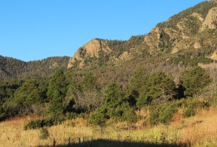
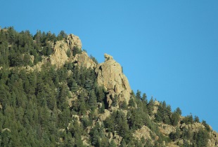
We only saw the headquarters and visitor's center open once, the day we arrived. The other days, we left early and got back late. We never had a chance to re-visit the impressive new visitor's center.
The park facilities were very new and clean. The pay shower raised some eyebrows - four quarters for four minutes. We discovered that the best time to shower was right after someone else had already gotten the hot water flowing - our four minutes began with hot water.
Monday
We woke at pre-dawn, had a light breakfast, and drove 25 minutes through Colorado Springs to Manitou Springs to take the Pikes Peak Cog Railway (founded in 1889 by Zalmon Simmons, also founder of the Simmons Beautyrest Mattress Company) to the summit of Pikes Peak.
If we had been in the mood for an advanced hike to the summit, we could have taken the Barr Trail from Manitou Springs. The trail is 12 miles long, rises 7,800 feet in elevation, and takes (on average) about 6 to 10 hours to hike.
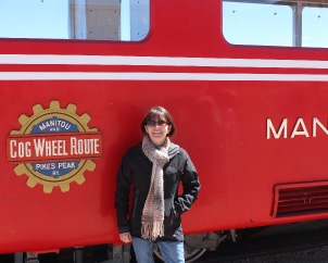
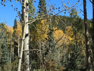
On the train, we sat across from Larry and Barbara, a friendly couple from Ohio who happened to be in Colorado Springs attending a wedding. It was fun exchanging life's experiences with them as we rode the slow train to the top of Pikes Peak.
The weather couldn't have been better at the summit. The temperature was in the mid-forties, the wind was light, and the skies were clear. The northern mountains of New Mexico were visible, as were the higher elevations of Oklahoma.
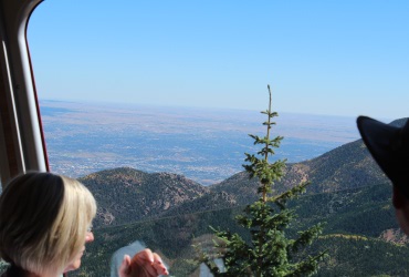
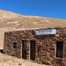
We were surprised to learn that although Pikes Peak is only 323 feet less in elevation than the highest point in Colorado (Mt. Elbert - 14,433 ft.), Pike's Peak ranks number 30 on the list of highest Colorado peaks. There are over 50 peaks in Colorado with elevations over 14,000 feet (known as the "14ers").
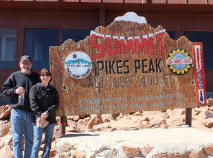
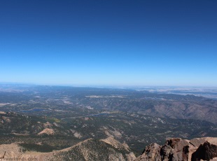
The Cog Railway stopped for about 40 minutes at the top of Pikes Peak. We had that much time to go to the restroom, buy hot chocolate and a famous donut from the cafe, and take pictures of the spectacular views from the summit. As promised, the train conductor rang the bell, signaling an on-time departure, and we were back aboard and down the mountain in about an hour.
The journey to the top of Pikes Peak made us hungry and thirsty. We ate lunch at the Colorado Mountain Brewery and sampled the 7258 Blonde Ale and the OLE 59ER Amber Ale. Both were quite delicious and refreshing. I spotted a fly fishing outfitter across the street and planned a visit before we left Colorado Springs.
Tuesday
We started the day a little later than we did on Monday and made breakfast of eggs, bacon, and pumpkin bread at our campsite before heading to Garden of the Gods, about 20 minutes from Cheyenne Mountain State Park.
We started with the Garden of the Gods Visitor's Center and Gift Shop, where we bought more souvenirs, before making our way to the Garden of the Gods park and hiking trails.
Inside the Visitor's Center, one of the park's nature experts taught wide-eyed grade school kids about the wildlife and geographical characteristics of the Garden of the Gods park. I listened in while I examined the many exhibits in the Nature Center.
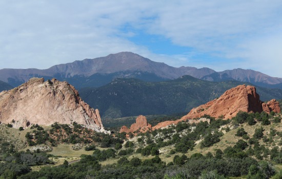
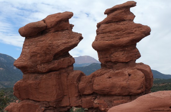
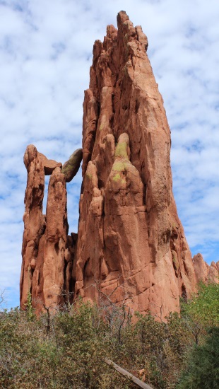
After taking pictures at the Visitor's Center, we drove a short distance to the main parking lot and walked on the Central Garden Trails to get close-up views of the many Garden of the Gods rock formations, such as the Cathedral Spires (below, top-right) and the Three Graces (below, left).
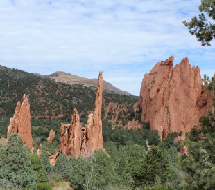
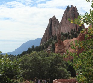
The hazy mountain in the background behind Kindergarten Rock (above, bottom-right) is Cheyenne Mountain. While taking pictures of the fascinating rock formations and magnificent views, we spotted a few of the park's birds: Black-billed Magpie, Western Scrub Jay, and Hairy Woodpecker.
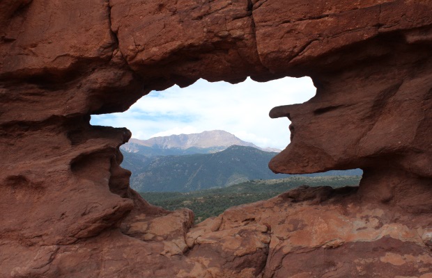
After strolling along the Central Garden Trails, we drove a few miles to the Siamese Twins Trail - this was an easy 1-mile loop that took us to the Siamese Twins rock formation (below). I snapped the picture of Pike's Peak at the top of this article through an opening in the Siamese Twins; one of the park's employees called it "Nature's picture frame."
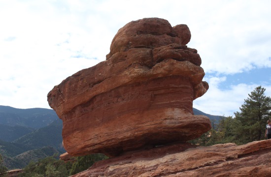
After hiking the Siamese Twins Trail, we drove further to see the amazing Balanced Rock. There are many activities at Garden of the Gods: biking, hiking, photography, and rock climbing, to name just a few. We could have easily spent several days at Garden of the Gods, hiking the trails and studying the park's geology and wildlife.
By the end of the day, we hiked about 6 miles - mostly in gift shops - and were ready for lunch and drinks. We ate grilled sandwiches at the Stagecoach Inn and had Dale's Pale Ale by Oskar Blues Brewery for dessert.
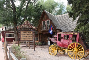
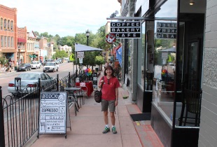
After lunch, we visited some of the local shops in Manitou Springs. On our way back to Cheyenne Mountain, we stopped at Pike's Peak Outfitters (the one across the street from the brewery) to get information on guided fly fishing trips. We couldn't fit one in on this trip, but someday we will.
Wednesday (First Day of Fall)
It was 54 degrees when we woke up - cold enough to turn on the heater in our travel trailer for 10 minutes or so.
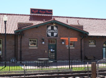
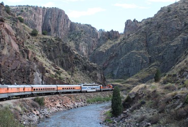
After a taco breakfast, we headed south from Cheyenne Mountain State Park on Highway 115, about 30 miles to Penrose, and turned west on Highway 50 to Canon City to take the Royal Gorge Route train along the Arkansas River through the Royal Gorge.
We arrived at the Royal Gorge Route train station about 2 1/2 hours early and decided that we had enough time to visit the Royal Gorge Bridge. We drove west on Highway 50 to the town of Royal Gorge, turned left on County Road 3a, and meandered toward the Royal Gorge Bridge Park.
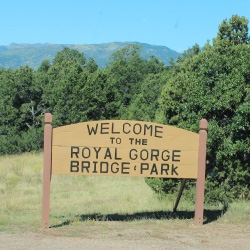
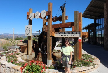
We paid 20 bucks each to walk on the wooden-planked suspension bridge (956 feet above the Arkansas River) and ride the gondola across the canyon. My palms were sweating when we boarded the gondolas. The ride is 2200 feet long and 1200 feet above the Arkansas River.
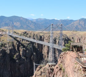
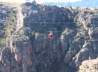
After visiting the Royal Gorge Bridge, we drove back to the train station in plenty of time to pick up our tickets and pay a visit to yet another gift shop. The train ride was a 2-1/2-hour, out-and-back route on the edge of the Arkansas River. We sat at a table with Joe and Silvia, a couple from Denver, who were celebrating their wedding anniversary.
We ordered an Angus Burger with fruit and a Red Bird Chicken sandwich. Both were excellent and paired well with a Laughing Lab Scottish Ale by Bristol Brewing Company.
You can buy differently priced tickets to ride the various train cars, but we chose the Vista Dome car because it has curved windows that allow you to view the top of the canyon.
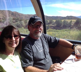
After lunch, we left the Vista Dome car to explore other train cars. While the train was moving, we passed through several train cars: a regular passenger car, a dining car, a bar car, and finally, the gondola car. Traveling between the train cars was like the Haunted Mansion ride at Disney World. You had to watch where you stepped and hold on to the handrails.
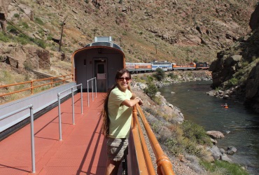
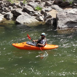
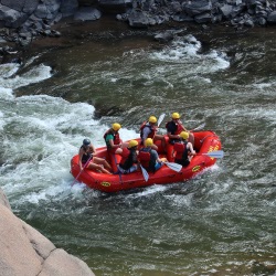
The views of the Royal Gorge Canyon and Arkansas River were spectacular.
After the train ride, we headed north on 67 through beautiful mountain countryside to Cripple Creek, Colorado. Since my last visit to Cripple Creek (30+ years ago), the town evolved into a sort of gambling center. We parked and walked down the main street looking for souvenir shops but discovered that most of the businesses in town had become casinos.
We weren't in the mood for gambling, but we spotted a candy shop and left Cripple Creek with just a tiny bag of taffy.
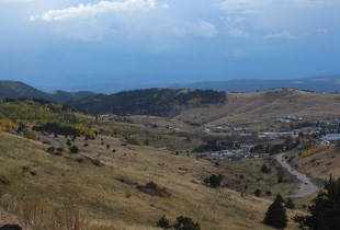
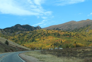
We continued north on 67 past Mueller State Park, to Woodland Park, right on Highway 24, and eventually back to Cheyenne Mountain State Park.
The Colorado portion of our RV camping trip was coming to an end. As always, there's never enough time to see and do everything, but we got to do everything we planned and made a list of the things we would like to do on our next visit (rafting and fly fishing come to mind).
Knowing that Thursday was going to be our longest travel day, we prepared our travel trailer before sundown for a pre-dawn departure; I even hooked up the trailer to the truck so that all we would have to do was disconnect the external power, lower the TV antenna, and be on our way.
Thursday
At 6:00 a.m. (Mountain Time), it was 51 degrees, and the sky was clear. I entered the location of our next destination (Palo Duro State Park, Texas) on the GPS, and the ETA displayed 7-1/2 hours. We left Cheyenne Mountain at 7:00 a.m. and headed south on I-25 toward Pueblo, where we stopped at another Cracker Barrel for a pancake breakfast before continuing our journey.
We continued south on I-25 with a full gas tank and two cups of hot coffee. The temperature was in the mid-sixties with a strong tailwind; we cruised effortlessly to Raton, New Mexico, where we filled up again and headed south on 87 back to Texas. At Dalhart, we stopped for gas and made sandwiches for the road at the dining table of our RV.
We continued south on 87 to Hartley, then further south on 385. At Channing, we turned left onto 354 (a bumpy road from hell), then south on 87 through Amarillo. We arrived at Palo Duro State Park at 3:30 p.m. Central Time, secured campsite number 16 in the Hackberry Camping Area for a two-night stay, and relaxed the rest of the evening.
Friday
The skies were clear at dawn, and the temperature was a cool 51 degrees. We ate bacon and eggs for breakfast before departing on a 5-mile hike through Palo Duro Canyon.
The canyon is about 120 miles long, 20 miles wide, around 800 feet deep, and exposes about 250 million years of geologic history (according to the Texas Parks and Wildlife website).
Our circuitous hike started with the south-easterly 1.17-mile Rojo Grande Trail, which connects to the Sunflower Trail (also 1.17 miles), then returned on the Juniper/Cliffside Trail (2.83 miles) that generally headed northwest and back to our starting point.
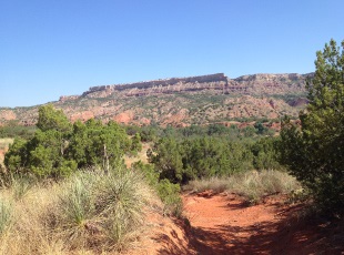
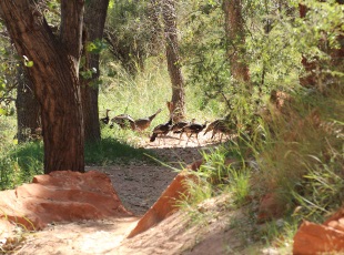
It was a sunny hike, though the Rojo Grande and Sunflower trails were supposed to be shady. I'd say the sun/shade ratio was about 80/20. The temperature warmed to the low 90s after about 30 minutes into our hike. We wished we had left a little earlier, but the scenery was magnificent.
We returned to our campsite in the late afternoon, positioned folding chairs under shade trees, and enjoyed cold ale while we chatted about the things we saw along the trail. In the evening, we had steak and beans (cowboy food) for dinner and went to sleep early after a long day.
Saturday
We woke up pre-dawn (again) and left Palo Duro State Park to return to Abilene in time for the Abilene Beer Summit (ABS).

After a 4-1/2- hour drive, through a couple of small storms, we arrived at Abilene State Park wearing beer shirts and feeling rested and energetic.
The ranger at the park's headquarters noticed our shirts right away and asked us if we were planning to attend the Abilene Beer Summit. We smiled and said, "Yes! We drove from Colorado Springs for the event!" He smiled. We got campsite 56 right next to the one we had the week before. Abilene is a relatively small town, and though Abilene State Park is a few miles from town, it only took about 25 minutes to get to downtown Abilene.
We were happy to attend the Beer Summit this year since we missed the Austin Beer Festival (also held in September) two years in a row. There were 45 different brewers at the festival. Some of them had multiple beers to choose from. Nevertheless, there was no way we could try them all in just one afternoon.
After a few ale samples and a BBQ sandwich, we drove (sober) about 20 miles, through more rain, back to Abilene State Park and spent the evening, warm and dry, inside our RV, listening to the sound of water dripping from the rain-soaked trees.
Sunday
We woke up about 30 minutes after sunrise and made our last bacon, eggs, and toast breakfast before preparing for our final journey home.
What Next?
Leave RV Camping Colorado Springs and visit our homepage.


